
- The San Rafael Swell is a 3000 square mile arid desert region.
- Little Wildhorse Canyon is a great family hike.
- Serious Canyoneers will love exploring Little Black Box.
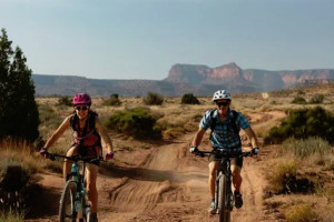
- Drive or bike ten miles to Temple Mountain.
- San Rafael is divided by interstate 70.
Overview
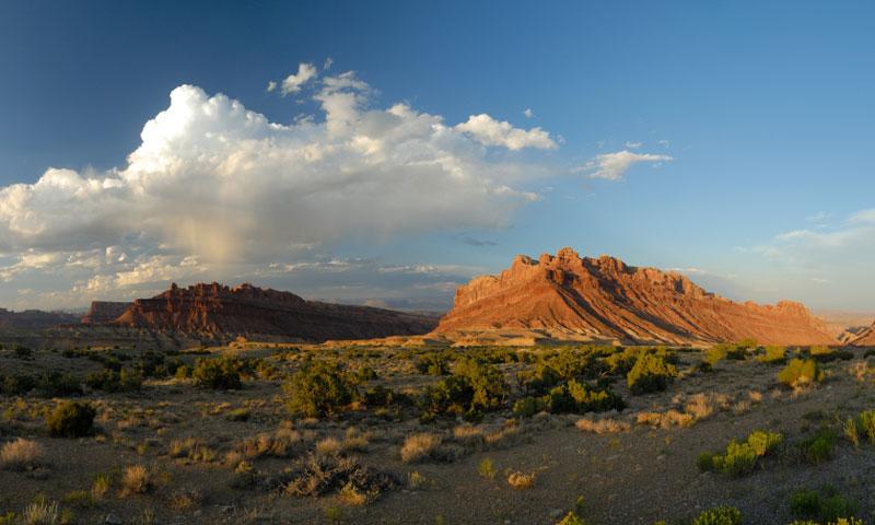
The San Rafael Swell is a vast and beautiful 3000 square mile desert tract with a giant sandstone anticline that was thrust up from the earth millions of years ago. Erosion from harsh winds and flooding created the swells beautiful canyons, gorges, mesas, and buttes.
Location & Information
San Rafael Swell is part of the Colorado Plateau, located 30 miles west of Green River, Utah on Interstate 70. Currently owned by the BLM, the area is accessible to visitors free of charge.
Little Wild Horse Canyon/Bell Canyon Loop
Directions: Take the Goblin Valley Road Exit and turn at Little Wild Horse Canyon Rd.11 miles from Hwy 24. Drive 5.3 miles more to the trailhead.
Little Wild Horse Canyon is a family favorite, and one of the most popular slot canyon hikes in Utah. Hike small parts of the canyon or spend the day exploring the full 8 mile loop, but remember to bring plenty of water.
- Easy
- 8 mile loop
- Flashflood warning in effect if it rains anywhere in the drainage
- Free access
Lower Black Box
Trailhead: Lower Black Box Trailhead at Old Sulphur Springs
51 miles from Green River on a high clearance 4x4 road, serious canyoneers can explore the 400 foot high walls of Coconino sandstone, in the slot canyon created by the San Rafael River. Visiting this site requires good planning and top notch canyoneering skills. It is one of the most primitive areas in the Swell, and emergency services are not readily avaiable. Exploring the Lower Black Box requires hiking, swimming, wading, and climbing skills.
- 7-8 hours round trip
- Life jackets, dry bags, hiking boots required
- Strenuous-Canyoneering skills required
- Spotted Wolf Canyon Map required
Temple Mountain
Directions: The road to Temple Mountain is a side track that branches off 1/2 way to Goblin Valley State Park-6 miles from Utah 24.
Located in the Southern section of the Swell, visitors can drive or bike through the South Temple Wash canyon to Temple Mountain. Used as a uranium mining area from 1910-1960, shafts, buildings, original mining equitment, including a winch tower, and remnants of a settlement known as the Temple Mountain Village still mark the landscape.
Fun Fact
Herds of wilds horses roam the San Rafael Swell.


